
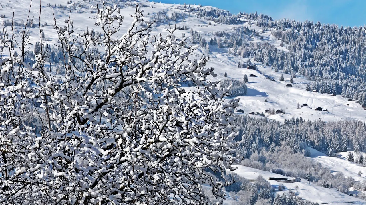
Winter arrived early in Switzerland this year, covering much of the country in snow even before the winter season had officially begun.
It is only November and the winter doesn’t officially begin until December 21st, but residents of many parts of Switzerland had an early glimpse over the weekend of what lies ahead in the coming days.
According to the official government meteorological service MeteoSchweiz, “the polar air mass brought a very sharp cold snap” in the past few days.
As a result, “many locations recorded their coldest temperatures of the year, and a new record was even set in Ebnat-Kappel. Since measurements began in 1971, no temperature lower than on Sunday November 23rd,(-15.7°C) had ever been recorded in November.”
Switzerland’s lowest temperature, however, was recorded on Sunday at La Brévine, in canton Neuchâtel, where it plummeted to -26.3C.
This is in stark contrast to the first half of November, when people in many regions of the country enjoyed unseasonably mild temperatures.
What is the cause for this cold snap?
Blame it on the phenomenon called the ‘polar vortex.’
It is a vast area of very cold air that rotates in a circle above the Arctic (and Antarctic) in winter, at a high altitude. This vortex is maintained by strong winds that usually trap the cold near the pole.
A likely scenario, according to meteorologist Peter Wick, is that this phenomenon could “open the floodgates of Arctic cold air,” which would then flow freely southward and reach Switzerland.
Advertisement
What weather we expect in the coming days?
By Tuesday, November 25th, MeteoSchweiz’s forecast calls for temperatures to drop, with the rain-snow line falling to around 500 meters by Wednesday.
“In the plains precipitation will be intermittent, but frequent on the northern slopes of the Alps, and occasionally persistent,” the weather service said.
Until Wednesday evening, “an additional 20 to 40 cm of fresh snow will fall above approximately 900 metres, and possibly even more in some areas.”

