
The storm, named Benjamin, is expected to sweep across Switzerland on Thursday October 23rd, bringing violent gusts and heavy rain to many regions of the country.
The cause of the storm is a low-pressure system near the British Isles, which is sweeping Europe at the moment.
According to MeteoNews weather service, “Switzerland is on the southern edge of this low pressure system, in the strong wind zone, and an active cold front associated with this low pressure system will cross the country on Thursday.”
It is expected to be accompanied by intense downpours and violent gusts, which could exceed 80 km/h at low altitudes and more than 120 to 150 km/h in the mountains on the exposed ridges of the Prealps and the Jura.
Colder weather ahead
Significant drops in temperature are also to be expected, said the government meteorological institute, MeteoSchweiz.
Its forecast calls for “the passage of an active cold front with a temperature drop of 10C in 24 hours is also a factor that can temporarily worsen the intensity of gusts.”
This is what Thursday October 23rd will look like across the country, according to MeteoSchweiz:
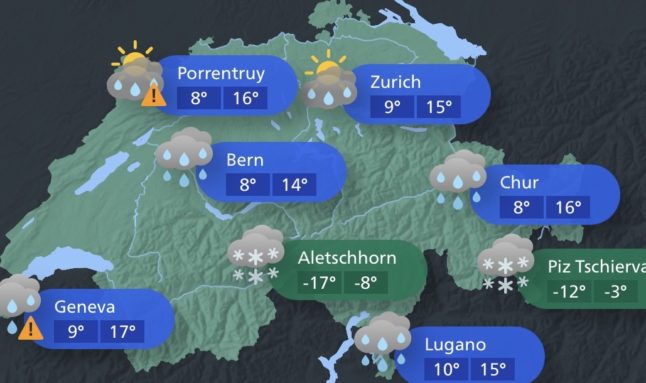
MeteoSchweiz
Advertisement
How long will the storm last?
According to the meteorologists’ current assessment, the storm will continue into Friday.
However, the wind will weaken somewhat during the night from Friday to Saturday.
It will remain light on Saturday and Sunday.

